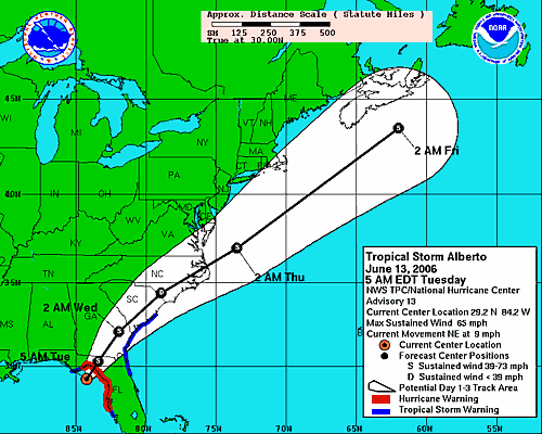
Wednesday morning update: Most of the heavy rain is either west of us over Raleigh/Durham or east of us out over the stream. The local weather channel crawler on the bottom of the TV keeps pumping the tornado warning and winds to 35, higher gusts. Looks like the system has sped up (once it got to I-95) and will technically be by here this afternoon late. Of course all the rain shield is still out front of it, but it also looks like the Outer Banks slipped through the middle of the two heaviest parts.
No comments:
Post a Comment